
Jackass Pass is still snow-covered and Cirque of the Towers is not accessible.
|
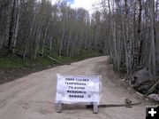
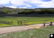
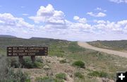
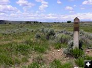
Road Closed
The road is closed at the beaver ponds, about 4 miles from the end.
|
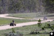
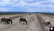
4-Wheeling Fun
There are miles of roads to explore with ATVs in the Big Sandy area.
|
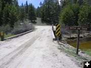
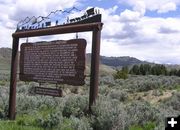
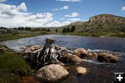
Dutch Joe Creek Bridge
There are many dispersed camping spots along the way. The road is closed about a mile past this bridge. There are dispersed camping spots on both sides of this bridge and in many places along this road.
|
|
Big Sandy current conditions
Road still not open to top yet
by Dawn Ballou
June 12, 2005
The Big Sandy campground and trailhead access road are still closed about four miles from the end, as of June 11th. We took a drive up that way on Saturday to scope out current conditions and see how far the road is open.
Quick summary: The road is open and dry to about a mile past the bridge over Dutch Joe Creek, with just a couple spots of remnant snow. There is a ROAD CLOSED sign in the middle of the road at the beaver ponds just before the road starts to climb. This is about 4 miles short of the campground, Big Sandy Lodge and wilderness trailhead access.
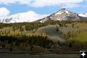
For those who want to hike the Continental Divide Trail or get over to Cirque of the Towers, those trips should be planned for July/August. There is plenty of hiking at lower elevations right now, but the high country and mountains still have a lot of snow. It will still be about another full month before Jackass Pass is free of snow to cross to the other side of the Continental Divide, and the climbing rocks are snow-free.
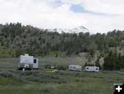
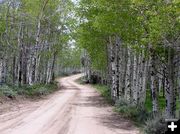
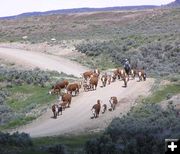
The drive to Big Sandy is beautiful right now, with signs of spring everywhere. The aspen trees are starting to get their leaves and have that fresh light green color. Roads are dry and great for 4-wheeling. There already are campers up there and people fishing and 4-wheeling, with many dispersed camping spots available to those who want to tent or dry-RV camp.
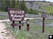
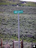
This makes a great long day drive or destination for an early spring camping outing. It�s remote and far from services, so be sure to have a full tank of gas and a good spare tire along. Access is via Boulder Highway 353 south of Pinedale, following the signs to Big Sandy Campground along the gravel Lander Cutoff Road.
Bring whatever food and drinks everyone will want for the whole day, because there are no services once you leave Boulder (or Farson if coming up from the south). Some maps still indicate a town called Big Sandy along the way, but this is just an intersection with some homes and no services.
Big Sandy is about 60 miles one way from Pinedale, most of which is on back country gravel and rough dirt roads. It's slow going in places, so be sure to plan for plenty of time so you won't be rushed. If you�ve never been up there before, bring a map because the route getting there is a bit confusing. Maps and directions are available from MapQuest.com website. Big Sandy Lodge also has a good map with directions on their website: www.big-sandy-lodge.com.
The last ten miles of the road are the steepest and roughest. There are some muddy spots in the valley bottom, but the rest is in relatively good condition. We saw sedans, trucks, campers and RVs in dispersed campspots as far up as the Dutch Joe bridge. The Forest Service advises a maximum 22 foot RV length limit. We recommend a high-clearance, 4-wheel drive vehicle, rather than a sedan, especially when the road is wet.
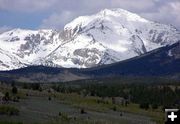
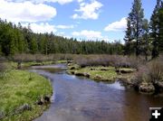
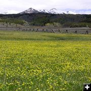
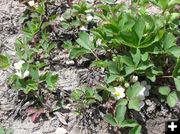
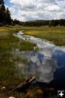
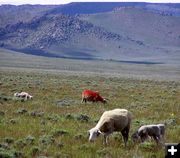
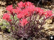
The views of the snow-capped mountains are awesome. Big Sandy Opening is located at the southern end of the Wind River Mountain Range, the heart of the Rocky Mountains and Continental Divide. The open fields are brilliant with blooming yellow buttercups. Wild strawberries are blooming along the roadside and will have berries in late summer. Big Sandy Creek is running a bit brown in color yet, but not particularly fast or high. The terrain is dry enough for hiking in the forest and there are miles of two track back roads for exploring on 4-wheelers.
Mosquitoes are out.
Day-time temperatures are t-shirt weather, evenings and nights get cold, so bring clothes to layer, including a coat. This time of year, the weather can go from warm and sunny in the morning, to afternoon thunderstorms with rain and lightning, to waking up to 4 inches of new snow overnight. We recommend being prepared for changeable weather.
Photos by Clint Gilchrist and Dawn Ballou
|