
Dave Crowley
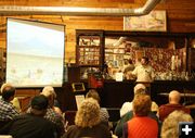
Pinedale BLM Archaeologist Dave Crowley gave a presentation about the Wagner Variant of the Lander Trail to members of the Green River Basin chapter of the Wyoming Archaeological Society on June 15th. The meeting was held at the Green River Valley Museum in Big Piney.
|
|
WAS Meeting at the Green River Valley Museum
by Dawn Ballou, Pinedale Online!
June 15, 2010
The Green River Basin Chapter of the Wyoming Archaeology Society held their June meeting on Tuesday, June 15th at the Green River Valley Museum in Big Piney.
Special guest speaker was BLM Archaeologist Dave Crowley who gave a presentation on the newly rediscovered "Wagner Variant" of the Lander Trail.
The Lander Road is a 256-mile road that was actually surveyed and built by the U.S Government in the mid-1800s to help facilitate the movement of people traveling from the east to the west across the country as part of the Oregon/California trail migration. Built in 1858, it was the first road constructed west of the Mississippi. It was plowed, graded, had bridges built for stream crossings, and dugways constructed for it. Fredrick Lander was the leader of the survey and construction project for the road, became the namesake for the road, although the official name was the Fort Kearney, South Pass, and Honey Lake Wagon Road.
The road leaves the main Oregon Trail route just west of South Pass on the southern end of the Wind River Mountain Range. It goes through Sublette County just north of Highway 351, through the Pinedale Anticline gas field development, through the Sublette County Fairgrounds and Big Piney airport, into South Piney Creek canyon up into Snyder Basin, across the Wyoming Range and over to Fort Hall, Idaho. It saved nearly a week’s travel over the original main route and avoided costly river ferry crossings.
The Bureau of Land Management realized last August that the location shown on modern-day maps for a 7-mile portion of the trail is incorrect. They made the discovery as part of their analysis and comparison of Government Land Office maps, Lander party survey maps and notes, and GPS coordinate overlays comparing old maps with new maps.
Laws require the protection of historic trails, and the main trail is protected by a Ľ-mile No Surface Occupancy buffer on either side along its path, protecting the trail and viewshed from intrusion by natural gas development through the Pinedale Anticline gas field development area.
When everyone realized there was a new section of the real Lander Road that went north of what has been shown as the Lander Trail on modern maps, it caused quite a stir. Federal law requires the BLM to protect cultural resources whenever they are discovered, so land managers couldn’t just ignore the new segment of trail. It had to be brought under the same protections as the rest of the historic trail. The problem was that a number of Shell and Ultra Pinedale Anticline gas wells which had been located away from the main trail now fell within the new Ľ mile No Surface Occupancy rules for the new trail section. Gas company reaction boiled down to "You gotta be kidding me."
What ensued was many months of discussions on how to shuffle things around and do mitigation which would allow a workable well drilling plan for the gas companies while adequately protecting the national historic trail.
Compromises were worked out and things were shuffled a bit. As part of a rewrite of a Programatic Agreement with the gas companies and PacificCorp for a new powerline, a land acquisition was agreed upon related to the Lander Trail. The details of this are still being finalized, but it represents an exciting new chapter for public access, appreciation and education about the Lander Trail and Oregon Trail emigrant history.
The new Green River Basin WAS chapter hopes to have some field trips out to the Lander Trail, as well as other interesting archaeological sites during the summer. Stay tuned for updates on these opportunities.
The next meeting of the Green River Basin WAS chapter will be July 19th at 7:00 PM at the Museum of the Mountain Man in Pinedale. Everyone is welcome.
|